Why Do You Need It?
Visual Clarity
.png)
Rather than explaining your project, you can present it visually for better understanding.
Increased Engagement
.png)
Customers can easily understand your vision and get more interested in your project
Easy to Use
.png)
Relatively simple to install and user-friendly for anyone to use
Visual Clarity
Rather than explaining your project, you can present it visually for better understanding.
Increased Engagement
Customers can easily understand your vision and get more interested in your project
Easy to Use
Relatively simple to install and user-friendly for anyone to use
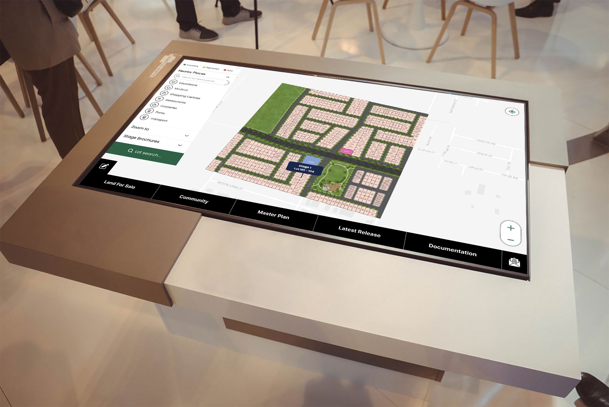
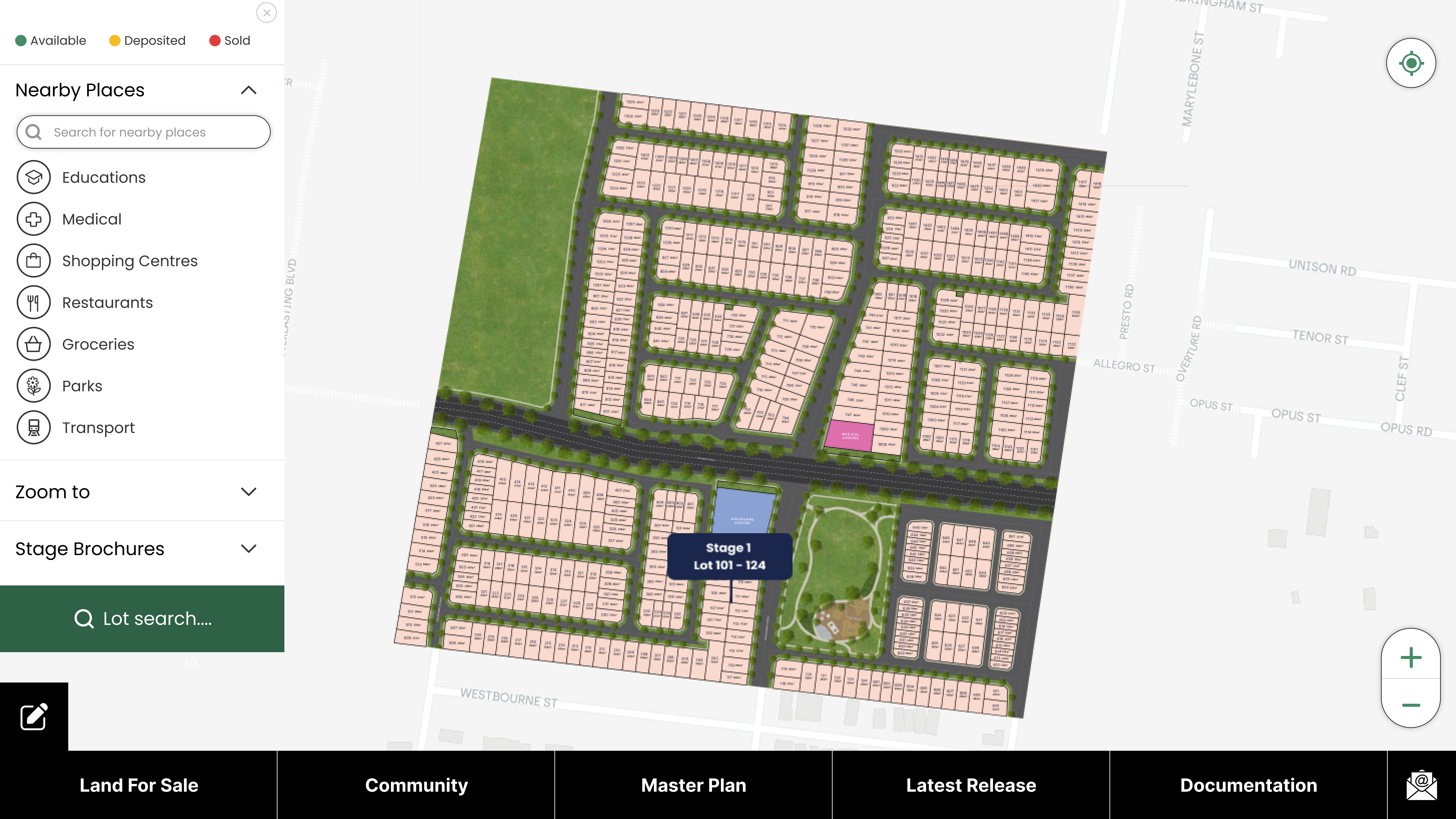
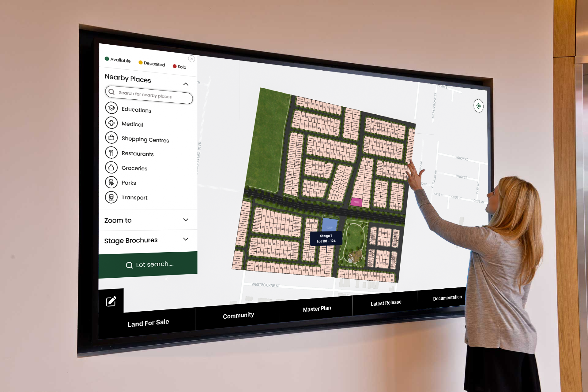
An Interactive Mapping Solution
Atlasight is a platform to revolutionize how businesses, developers, and real estate professionals showcase their projects. With interactive maps, real images, and detailed location data, users can explore developments dynamically. Whether you are presenting a new real estate project, a resort, or a land development, this innovative tool makes it easy to visualize and communicate your vision. Atlasight brings seamless website integration, real-time updates, and built-in lead management. This results in greater transparency, engagement, and easier project presentations. Users can zoom in and explore nearby amenities, experience projects like never before, and bring complex plans to life online or in person
Our Work
Swarna Estate
Swarna Estate
Swarna Estate
What is Atlasight?
Atlasight is an interactive mapping platform that will help businesses, developers, and professionals in the real estate space demonstrate their projects in an incredibly clear and beautiful way. It makes it simpler for clients and stakeholders to use and understand advancements by converting basic plans into live and immersive experiences.
How does it work?
Atlasight brings projects to life by integrating real-time maps, images, and location data. Users can zoom in and explore specific areas, view nearby amenities, and access real-world visuals. Real-time updates and built-in lead management ensure a smooth and interactive experience for presenters and viewers.
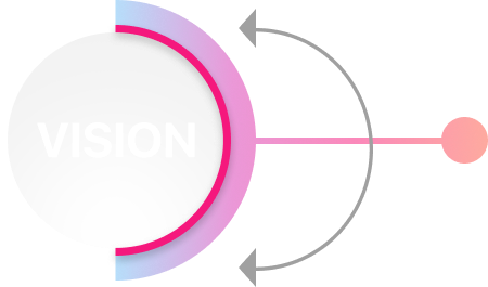
Our Vision
At Atlasight, we believe that project visualization should be easy, clear, and interactive. We want to help businesses, developers, and real estate professionals show their projects in a way that is easy to explore and understand. Turning basic maps into engaging experiences allows people to better see the full potential of a project, build trust, and make better decisions.
Why Choose Atlasight

Enhanced Project Visualization:
Bring your project to life in a way that static images or blueprints simply cannot.
Boost Client Engagement:
Engage potential buyers or investors by giving them the ability to explore the project from any device, anytime.
Efficient Lead Management:
The built-in CRM ensures you don’t miss a lead, providing you with a comprehensive tool to track, manage, and nurture prospects.
Seamless Integration:
Easily implement the platform into your website or presentation materials for a professional and polished appearance.
Key Features
 Interactive Map Display:
Atlasight lets you display your projects, plots, resorts, and developments on an
interactive map. Users can zoom in and explore specific areas with clear visuals
and detailed information.
Interactive Map Display:
Atlasight lets you display your projects, plots, resorts, and developments on an
interactive map. Users can zoom in and explore specific areas with clear visuals
and detailed information.
Real Images Integration:
Unlike static maps, Atlasight integrates real images and live data to give users
an authentic view of the project and surrounding areas. This helps to give a
true-to-life perspective of what the project will look like upon
completion.
Location Details &
Amenities:
The platform highlights important details, such as plot locations, nearby
amenities, and infrastructure developments. Users can easily view the proximity
of key facilities like schools, parks, roads, and shopping centers.
Customizable Map Embedding:
Easily embed your interactive map on your website, presentations, or promotional
materials. Atlasight offers a seamless integration, enabling you to bring your
vision directly to your audience.
Lead Management & CRM
Integration:
Atlasight goes beyond just visualization. Our platform includes a basic CRM
system to help you manage leads efficiently. Track inquiries, follow up with
prospects, and store valuable contact information, all within one easy-to-use
system.
User-Friendly Interface:
The platform is designed to be intuitive and simple to use, making it easy for
both developers and end-users to navigate, zoom, and interact with the map and
project data.
Custom Plot/Project Markers:
Pinpoint specific plots, land areas, or features on the map with custom markers,
providing clarity and detail on each segment of your project.
Real-Time Updates:
Keep your audience informed with real-time updates to the project location and
status. As developments evolve, your audience can see the changes reflected on
the map and get up-to-date information.
In a nutshell, Atlasight makes it easier for you to show your vision and get more
people excited about your project.
This version aims for clarity and conciseness, making it easier for a wider
audience to understand the value proposition of Atlasight
What Our Client Say
Atlasight has elevated how we present our properties. Clients can explore the site virtually, view actual surroundings, and understand the project’s location advantages without ever stepping foot there. It’s made our pitches far more compelling.
David R
Commercial Property Developer
Before Atlasight, we struggled to convey the full picture of our developments. Now, with interactive maps and real imagery, buyers feel more connected to the space. We've seen an increase in inquiries and faster decision-making from potential homeowners.
Laura B
Residential Project Manager
Using Atlasight helped us bring our entire portfolio to life online. Prospective buyers love how easy it is to visualize the neighborhood, nearby amenities, and project layout. It’s a huge advantage in today’s digital-first market
Thomas W
Real Estate Marketing Director
Atlasight has revolutionized the way we market our real estate projects. Previously, clients would be shown static images and presentations...
Zoye
Construction
Frequently Asked Questions
Yes! Atlasight allows you to deliver instant updating of your project: new plotting, construction, and amenities. With these changes to live updates, clients, stakeholders, and investors will always possess the most current information regarding your projects' development.
Yes! Atlasight values usability in its architecture. Technical skills are not necessary for one to navigate through the platform, upload projects, and assign markers to the map. Most of the interfaces have been made User-friendly to the extent that developers, sales teams, and clients can all navigate the projects with ease-presentations becoming lively and impactful.
Atlasight is right for real estate developers, property consultants, urban planners, and tourism business analysts. This includes the presentation of residential projects, resorts, and commercial properties, even large-scale infrastructure schemes; Atlasight is the perfect interactive way to present projects, focusing on important details while fully engaging potential buyers and investors.
Of course! Atlasight allows you to customize your interactive map with project-markers and highlighted plots, as well as with real pictures of the site. You can customize your map so that it corresponds with your company's branding, thus creating a potent presentation, marketing, and customer engagement instrument.
Atlasight, therefore, renders customer engagement more interactive during project presentations by allowing clients to peruse locations, check some nearby amenities, and review live updates. A more active experience keeps the minds of potential buyers occupied while adding a level of comfort fostering their understanding of the project and helping them make investment decisions.
Get in touch
Lorem Ipsum is simply dummy text of the printing and typesetting industry. Lorem Ipsum has been the industry's standard dummy text ever since the 1500s, when an unknown printer